7 days MTB Tour. So 7 Days MTB tour. At last, 7 Days MTB Tour.
The proposal we offer is a 7 days MTB Tour / 7-night tour, (6-day cycling) through El Bierzo (see Trans Bierzo MTB ). However, we can cut the proposal to a 6-day MTB / 6-night route or even 5 days / 5 nights. These other proposals can be similar stages in terms of mileage and gradient. Or, on the contrary, somewhat longer stages to be done in fewer days.
However, based on the experience of the various groups that have completed the route to date, the option presented is the most «reasonable», alternating fairly demanding stages with more difficult ones…
On the other hand, every day we pass by some establishment where it is possible to eat something. A restaurant, a brasserie, a tavern,… and always a little further than halfway through the stage. In addition, if we asked in advance, they have always allowed us to recharge our batteries. We recommend leaving a little tip; they pay for the battery power! 😉
Day 1. Orellán.
Arrival in Orellán. If there is time, we recommend visiting Las Médulas. Currently declared a Natural Monument, it is an old Roman gold mining operation, although it is known that earlier towns had already exploited the area. It really is a wonder!
Accommodation in the same establishment, with dinner included. Tomorrow begins the adventure of the 7-day MTB Route through El Bierzo and it’s time to rest!
Day 2. Orellán – El Acebo.
54 km and 1,865 m. accumulated positive gradient.
After a good breakfast, the route begins. Today’s stage is the most demanding in terms of elevation.
From Orellan (770 m), the route begins to climb towards Ferradillo (usually uninhabited) at about 1,260 m. and after passing the Collada de la Nevera, at 1,400 m., and a short 6 km stretch along the ridge, the descent begins towards the town of Montes de Valdueza at 900 m. There, a huge monastery appears, in ruins.
A short stretch of road goes up towards Peñalba de Santiago at 1,090 m. and, along the Camino de Matalachano to almost 1,240 metres, maintaining the height until the vicinity of San Cristobal de Valdueza, where there is a good inn, ideal for eating. In fact, you are 2/3 of the way there.. At the exit, there is a famous thousand-year-old yew tree, the pride of the town.
From here you will have to cross a small stream and climb again towards Espinoso de Compludo, famous for the size of a large chestnut tree. There is also a good tavern here to eat.
Next, you have to cross a hill (at 1,188 m) to go down to Compludo, without a doubt one of the most authentic villages on the route; with streets still unpaved. Many stone houses are authentic and centuries old. Few villages are as original as Compludo…
But you are almost at the bottom of the valley and so you have to climb again, this time gently, for several kilometres to finally reach El Acebo. The track does not enter the village, but stays about 100 metres away, in a good accommodation (with a swimming pool included!). Dinner included. The first day of the 7-day MTB Route of the Trans Bierzo MTB concludes.
Day 3. El Acebo – Igüeña.
55 km. and 1,298 m of accumulated positive elevation gain.
After breakfast, the second day of the route begins, much more feasible.
It starts towards the north, towards Riego de Ambros, through the towns of El Abresedo and the almost deserted Castrillo del Monte.
Then, it goes up towards the “Alto de Cotejeron” wind farm at 1360 m., the highest point of the day. From there you will follow good tracks, crossing the enormous wind farm and descending along tracks to San Facundo, at the bottom of the valley. A small village that has managed to attract tourists, with colorful houses and pretty streets. And with a beautiful river beach (very common in El Bierzo)!. In the middle of the village there is a very good restaurant.
The track goes down little by little towards San Andrés de las Puentes. Thus, it enters the fairly urbanized area of Ventas de Albares, near Bembibre; One of the most populated municipalities in the area (9,000 inhabitants) at the bottom of the valley.
The main roads and highways that cross the Bierzo pass through here, transversally. In addition, there are small industrial estates and the buildings created do not favor the environment.
But from there, it goes up very gently towards Folgoso de la Ribera. It is a town with a certain charm… where a small irrigation ditch runs through it. The town has a curious museum of Christmas figures but they are only open at Christmas.
Following the Boeza River, along the old path (parallel to the road) you reach Boeza. There are still about 5 km left, half on track and half on road, to finally reach Igüeña.
The accommodation is not far from the well-known river beach, known as Playa del Catón (or del Catoute). In fact, this is close to the restaurant where you will have a comfortable dinner.
Day 4. Igüeña – Vega de Espinareda.
55 km. 1,001 m. accumulated positive gradient.
After breakfast, one of the most difficult stages of the Trans Bierzo begins.
Today’s option does not go up towards the high mountains of the northernmost Bierzo, but goes directly to the Vega de Espinareda, to the West. Thus, it follows more or less parallel to the local road LE 4306, either up or down (it crosses it several times) passing through the various villages in the area. First, the route goes back about 2 km to find the Camino Olvidado, the old path from when there were still unpaved roads to the West.
In short, the route alternates mountain paths, forest tracks and some paved roads, passing through many villages: Quinata de Fuseros, Nocera, Robledo de las Traviesas, the town of Berciego, Villar de las Traviesas and Libran. Villages not dedicated to tourism but where country people live and work and small services (a workshop, a shop…) are provided. The villages of northern Bierzo are more populated, there is more life and more social and economic activity.
Finally, Toreno. The activity and social life of this town of 3,000 inhabitants, which in the 1960s had almost 7,000, is surprising. Passing in front of the House of Culture, at the top of the town, you will see a curious clock from 1906 in which two large numbers tell the time. The town has several restaurants, but we recommend one at the entrance…
Next, Tombrio de Abajo, Tombrio de Arriba and Berlanga del Bierzo, linking the three villages by a small road. Then, the route climbs between mountains until reaching Vega de Espinareda. Crossing the Roman bridge you will see some magnificent facilities (also a river beach). Leaving the village, heading north, the track will take you to the accommodation, where you can enjoy a good dinner.
Day 5. Vega de Espinareda – Pereda de Ancares
50 km. and 1,383 m. cumulative positive difference.
Having had breakfast (included in the price), a comfortable and varied stage begins.
The first section, leaving Vega d’Espinareda and passing through the west of Fabero, is on roads and dirt roads until beyond Barcena de l’Abadia. The route then continues through the various towns at the bottom of the valley: San Pedro de Paradela, Cariseda, until reaching Peranzanares. There is a good place to eat there, and it is really worth it, because there won’t be another one for many kilometres of the route.
From here continue towards Guimara, where the road definitely ends. Soon you pass a «reproduction» of a Castro Celta, of what a village in the Bierzo was like. It is worth saying that the real one is further away, up, about a hundred meters. It is a place that is worth visiting and that, in the summer, sometimes there is a kind of «stop»/»chiringuito» where they can supply some refreshments… but don’t plug in any E-Bike.
But the route continues along the bottom of the valley, turning and continuing along the bottom of the valley of the Cua River, along the ridge of the Serralada Cantábrica now in a southerly direction. Little by little it goes up to the ridge to change the valley. The highest point is near the Refugio de la Pesca, reaching 1,612 m. From here, already on the southern, sunny slope, the route will descend constantly.
Finally, Suertes, in the other valley, that of the Rio de la Vega. There is still a short stretch to Pereda de Ancares. At 930 meters above sea level, where the accommodation is. A very good accommodation where we will enjoy a good dinner.
Day 6. Pereda de Ancares – Ambasmestas (option A)
52 km and 1.480 m. accumulated positive gradient (Short Route)
This first option of day 5 of the 7-day MTB Route is, in general terms, a good route, with many stretches of asphalt.
After breakfast, a gentle climb begins towards Pico Pirandelo, to be able to change valleys. But on the other side of the peak, the descent towards the Burbia Valley has a brutal incline.
Thus, once in Burbia, the route follows the course of the valley for several kilometres, mainly on asphalt. Between an environment of slate rocks, you cross Aira da Pedra and Veguellina, turning towards Paradaseca on a gentle climb along the road. After crossing Sotelo (and previously Cela) you leave the asphalt. Now comes the second good climb of the day along the Cantejeira path (where there is a well-known Palloza).
The landscape in Cantexeira is totally different: wide, open, with extensive meadows and fields of crops… But the track continues downhill, alternating stretches of road with tracks (some paved) after crossing Pumarin until reaching Balboa, with a considerable gradient.
Balboa has a remarkable charm. It has a well-known palloza and restaurants. In fact, Balboa is a good place to eat and recharge your batteries.The ruins of a nearby castle confirm that it was once important. In fact, it is the centre of the more than 15 villages that surround it, including Cantejeira (Cantexeira)..
A final fast stretch, 3.5 km this time on paths and trails, partly compensates for the high degree of asphalt on the day’s route. Finally, Ambasmestas. There you will find a good dinner in good accommodation.
Day 6. Pereda de Ancares – Ambasmestas (option B)
56 km and 1.816 m. positive cumulative gradient.
The second option is a high mountain route, with several sections rolling along the summits, between peaks and without passing through any towns. The landscapes are more impressive, but the stage is the most demanding of the 7-day mountain bike route.
After breakfast, a gentle climb begins towards Pico Pirandelo, to be able to change valleys. But on the other side of the peak, the descent towards the Burbia Valley has a brutal incline.
Thus, once in Burbia, the route follows the course of the valley, but soon begins to ascend towards Campo del Agua, a semi-abandoned village, which preserves numerous houses with roofs (pallozas) and ancestral granaries. Some buildings have recently been rebuilt.
But the route continues, after crossing two valleys (Porcarizas and Valonga), before descending considerably towards Tejeira (Texeira), the only inhabited centre on this section. There is a restaurant there to eat, but not always…
Leaving Teixeria, the route climbs again towards the top of the Sierra de Ancares, winding between peaks for several kilometres, until finally reaching the Sierra de Canteixeira. The route descends along the crest of the Sierra to Cantejeira (and its well-known palloza).
The landscape in Cantexeira is different: wide, open, with extensive meadows and cultivated fields… But the track continues in a steep descent, alternating roads with tracks (some paved) after passing through Pumarin, to Balboa.
Balboa has a remarkable charm. It has a well-known palloza and restaurants. The ruins of a nearby castle confirm that it was once important. In fact, it is the centre of the more than 15 villages that surround it, including Cantejeira (Cantexeira).
A final fast stretch, 3.5 km this time on paths and trails, compensates for the high degree of asphalt on the day’s route. Finally, dinner and good accommodation in Ambasmestas.
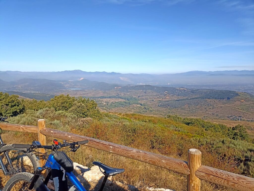
Day 7. Ambasmestas – Orellán.
53 km. 1.314 m. positive cumulative gradient.
After a good breakfast, the route follows the Camino de Santiago in the opposite direction, to Trabadelo. By road, you leave the bottom of the valley and head by road to Moral de Valcarde, passing through Parada de Soto first. Here you take the «French Way» that climbs sharply to «O Portelo», where you descend in a few metres to Cadafresnas. Nearby there was an important tungsten mine…
You soon descend to the bottom of the valley of the Selmo River, a tributary of the Sil. On the long descent, alternating stretches of track and paved stretches, you pass through the towns of Viariz and Hornija.
Once at the Selmo River, follow a small path/trail (easy and fun) that runs parallel to the road on the other side of the river. Finally, Sobrado, where there is a good restaurant on the other side of the beautiful river beach.
After crossing Friera, take the National Highway 120 to cross the Sil River. This is the only point of some traffic during the day. Luckily, after leaving the bridge, take a path that goes up to Carucedo Lake.
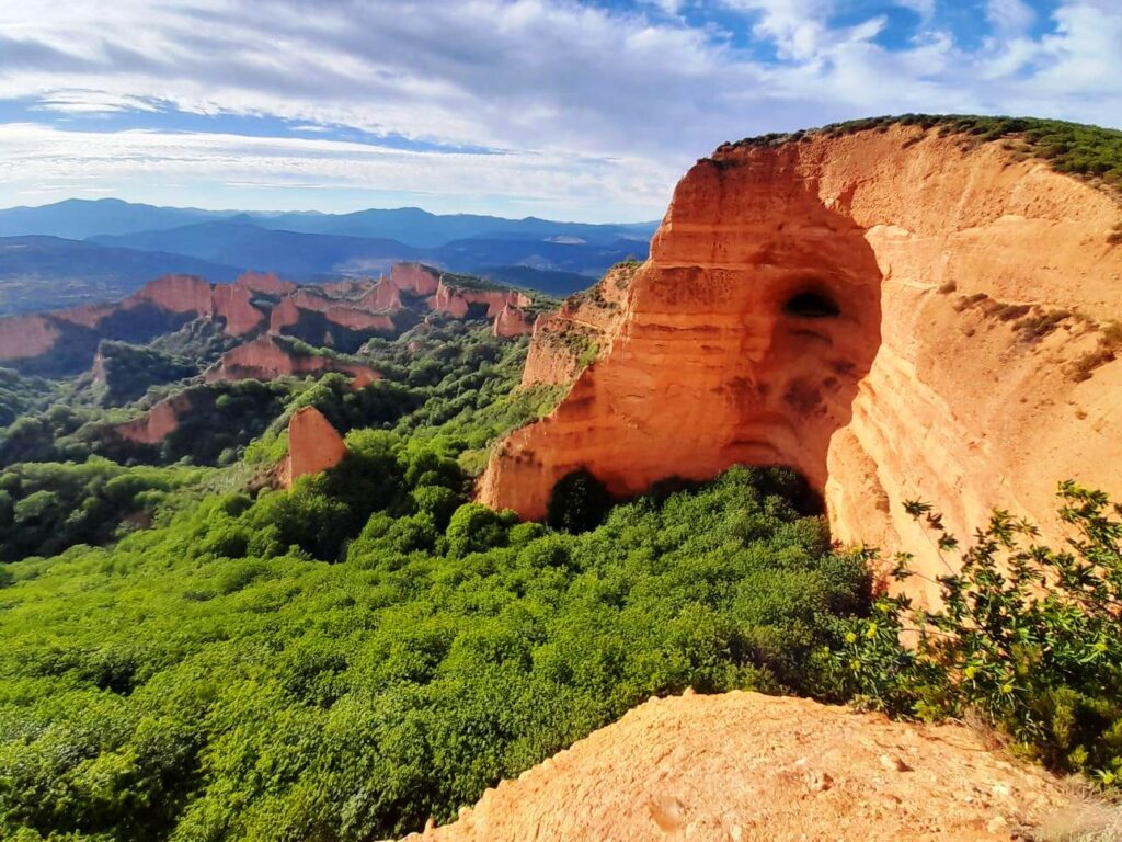
The small village is the tourist centre of the area because of its beautiful lake. Local legend has it that it was formed by the tears of a nymph in love… but the truth is that, due to the dense vegetation, it can hardly be seen from a bicycle…
There is only the final climb left, which links several paths: the Chao de Maixeiras, the Barreia, the “winter” path to the Mirador de las Médulas. In case you missed it on the first day, you will be impressed!
Finally, Orellán. There you will find your luggage.
END OF ROUTE
7 days MTB Tour. So 7 Days MTB tour. At last, 7 Days MTB Tour.
INCLUDES (Normal Version)
- 7 Accommodations during the route on a half-board basis (double room with separate beds).
- Luggage transport from accommodation to accommodation.
- Tracks and maps of the route.
- Mandatory insurance (includes rescue in case of accident).).
INCLUDES (Assisted Version)
- 7 Accommodations during the route on a half-board basis (double room with separate beds).
- Support vehicle during the route, with the transport of luggage, tools, cameras, tires, gear cables, and other spare parts.
- A minimum of one refreshment per day on the route, based on nuts, fruit, juices, cookies, chocolate,…
- Tracks and maps of the route.
- Mandatory insurance (includes rescue in case of accident)
NOT INCLUDES
- Anything not specified in the «INCLUDES» section.
- Bike rental (see prices and reservations).
- Single room (see prices and reservations).
- Optional cancellation insurance (see prices and reservations).
- Provisioning on route (ASSISTED VERSION) (see prices and reservations)
- Extra night on the last day of the route (optional half board: dinner, accommodation and breakfast), in Orellán. (Optional, see prices and reservations).
7 days MTB Tour. So 7 Days MTB tour. At last, 7 Days MTB Tour.
